TYPES OF SATELITES


Gist


1. Communication Satellites

• Function: Relaying communication signals like television broadcasts, phone calls, and internet data.

• Orbit: Often use geostationary orbits for a fixed position relative to Earth

2. Earth Observation Satellites

• Function: Gathering data about Earth, including weather patterns, land use, and environmental changes.

• Orbit: Utilize various orbits depending on the specific data being collected.

3. Navigation Satellites

• Function: Providing positioning and navigation information for systems like GPS.

• Orbit: Typically use medium Earth orbits (MEO) for good global coverage

4. Scientific Research Satellites

• Function: Conducting scientific studies in space, like astronomy, astrophysics, and Earth science.

• Orbit: Can vary greatly depending on the research mission.

5. Military Satellites

• Function: Supporting military operations through tasks like reconnaissance, navigation, and communication.

• Orbit: Can vary depending on the specific military application

Other Types

• Weather Satellites: A subcategory of Earth observation satellites specifically focused on weather monitoring.

• Remote Sensing Satellites: Gather data on Earth's surface using various sensors.

Additional Points

• Some satellites can have multiple functionalities. For instance, a communication satellite might also be used for navigation purposes.

• The choice of orbit depends on the satellite's purpose. Geostationary orbits are ideal for fixed positions, while MEO or lower Earth orbits (LEO) offer better coverage for navigation or remote sensing.

• The number of satellites in orbit is constantly growing, with applications expanding into areas like internet access in remote regions and environmental monitoring.

• Understanding the different types of satellites highlights the vast potential of space technology for communication, navigation, scientific discovery, and various other applications.


Summary


• Communication Satellites: Facilitate long-distance communication through relaying signals between ground stations or other satellites. Examples include geostationary, low Earth orbit (LEO), and medium Earth orbit (MEO) satellites.

• Navigation Satellites: Provide accurate positioning, navigation, and timing (PNT) information globally or regionally. Examples include global navigation satellite systems (GNSS) like GPS, GLONASS, Galileo, and BeiDou.

• Earth Observation Satellites: Capture high-resolution imagery and data of Earth's surface, atmosphere, and oceans for environmental monitoring, disaster management, and scientific research. Examples include optical, synthetic aperture radar (SAR), and hyperspectral/multispectral satellites.

• Weather Satellites: Monitor weather patterns, atmospheric conditions, and severe weather events from space for weather forecasting, climate research, and disaster preparedness. Examples include geostationary and polar orbiting weather satellites.

• Scientific Satellites:Conduct experiments, gather data, and study celestial bodies, including planets, moons, asteroids, and comets. Examples include space telescopes, planetary probes, and Earth science satellites.

• Military and Surveillance Satellites: Support national security, reconnaissance, and intelligence-gathering missions through reconnaissance, navigation, timing, communications, and signals intelligence (SIGINT) satellites.

• Space Exploration Satellites: Explore and study celestial bodies beyond Earth's orbit, including planets, moons, asteroids, and comets, through orbiters, landers, rovers, interplanetary probes, and flybys.


Detailed content


Introduction to Satellites

Satellites are artificial objects placed into orbit around celestial bodies, primarily Earth. These man-made structures serve a multitude of purposes, ranging from communication and navigation to scientific research and Earth observation. Satellites are crucial components of modern society, enabling global connectivity, weather forecasting, environmental monitoring, and much more.

Historical Background

The concept of artificial satellites dates back to the early 20th century, with visionary thinkers like Konstantin Tsiolkovsky and Arthur C. Clarke proposing the idea of space travel and satellite communication. However, it wasn't until the mid-20th century that technology advanced sufficiently to make satellite deployment feasible. On October 4, 1957, the Soviet Union launched Sputnik 1, the world's first artificial satellite, initiating the space age and sparking a race for space exploration between superpowers.

Evolution of Satellite Technology

Since the launch of Sputnik 1, satellite technology has undergone significant evolution, driven by advancements in materials science, electronics, propulsion systems, and launch capabilities. Satellites have become smaller, more powerful, and more versatile, enabling a wide range of applications in various sectors, including telecommunications, navigation, remote sensing, and scientific research.
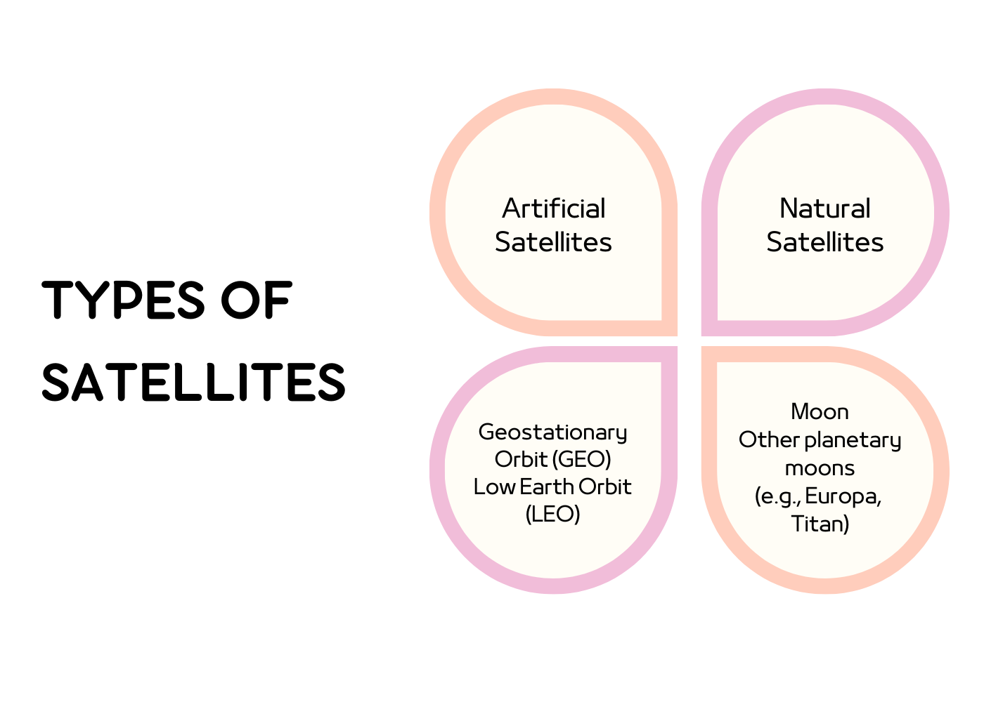
Types of Satellites

Satellites can be classified into several categories based on their orbital characteristics, mission objectives, and design features. Below, we explore the most common types of satellites used in space technology:

1. Communication Satellites

Communication satellites, also known as telecom satellites, are designed to facilitate long-distance communication by relaying signals between ground stations, or other satellites, over vast distances. These satellites operate in geostationary or geosynchronous orbits, allowing them to remain stationary relative to Earth's surface. Communication satellites are equipped with transponders and antennas to transmit and receive radio signals across different frequencies, enabling services such as television broadcasting, internet connectivity, and mobile communications.

Subtypes of Communication Satellites

• Geostationary Communication Satellites: Positioned in geostationary orbit (GEO) approximately 35,786 kilometers above the equator, these satellites orbit Earth at the same rotational speed as the planet, appearing stationary from a fixed point on the ground. Geostationary satellites provide continuous coverage over a specific geographic area, making them ideal for telecommunications and broadcasting applications requiring uninterrupted connectivity.

• Low Earth Orbit (LEO) Communication Satellites: Unlike geostationary satellites, LEO communication satellites orbit much closer to Earth, typically at altitudes ranging from 160 to 2,000 kilometers. While they offer lower latency and higher data transmission rates than GEO satellites, LEO constellations require a larger number of satellites to achieve global coverage. Companies like SpaceX's Starlink, OneWeb, and Amazon's Project Kuiper are deploying LEO satellite constellations to provide high-speed internet access to underserved regions worldwide.

• Medium Earth Orbit (MEO) Communication Satellites: Positioned at intermediate altitudes between LEO and GEO, MEO satellites orbit Earth at altitudes ranging from 2,000 to 35,786 kilometers. MEO satellites offer a balance between coverage area and signal latency, making them suitable for navigation and global positioning systems (GPS), as well as satellite-based internet services.

2. Navigation Satellites

Navigation satellites are designed to provide accurate positioning, navigation, and timing (PNT) information to users on Earth or in space. These satellites operate in various orbital configurations, including medium Earth orbit (MEO) and geostationary orbit (GEO), depending on the navigation system's requirements. Navigation satellites rely on onboard atomic clocks and precision instruments to continuously broadcast signals that can be received and processed by ground-based receivers or onboard navigation systems.

Examples of Navigation Satellites

• Global Navigation Satellite Systems (GNSS): GNSS is a constellation of satellites that provide worldwide coverage for navigation and timing services. The most well-known GNSS systems include the Global Positioning System (GPS) operated by the United States, the Russian GLONASS, the European Union's Galileo, and China's BeiDou Navigation Satellite System (BDS). These systems use a network of satellites in medium Earth orbit (MEO) to triangulate the user's position on Earth with high accuracy.

• Regional Navigation Satellite Systems: In addition to global navigation systems like GPS and Galileo, several countries operate regional navigation satellite systems tailored to specific geographic regions. Examples include India's Indian Regional Navigation Satellite System (IRNSS), Japan's Quasi-Zenith Satellite System (QZSS), and China's BeiDou-3 Navigation Satellite System (BDS-3). These regional systems augment the coverage provided by global navigation constellations and offer enhanced positioning accuracy for users within their designated areas.

3. Earth Observation Satellites

Earth observation satellites, also known as remote sensing satellites, are equipped with sensors and imaging instruments to capture high-resolution imagery and data of Earth's surface, atmosphere, and oceans. These satellites play a vital role in environmental monitoring, disaster management, urban planning, agriculture, and scientific research. Earth observation satellites can operate in various orbits, including low Earth orbit (LEO), polar orbit, and sun-synchronous orbit, depending on the desired spatial resolution and revisit frequency.

Types of Earth Observation Satellites

• Optical Earth Observation Satellites: Optical satellites capture imagery of Earth's surface using visible and infrared sensors, allowing for detailed analysis of land cover, vegetation, urban development, and natural phenomena. Optical satellites can be further classified based on their spatial resolution, spectral bands, and imaging capabilities. High-resolution optical satellites, such as the WorldView series operated by Maxar Technologies and the Pleiades constellation operated by Airbus Defence and Space, provide imagery with sub-meter resolution, enabling precise mapping and monitoring applications.

• Synthetic Aperture Radar (SAR) Satellites: SAR satellites utilize radar technology to produce high-resolution images of Earth's surface under all weather conditions, day or night. SAR sensors emit microwave pulses towards the ground and measure the reflected signals to generate detailed radar images. SAR satellites are particularly valuable for applications requiring cloud-penetrating capabilities, such as flood monitoring, soil moisture estimation, and surveillance. Notable SAR satellite missions include the European Space Agency's (ESA) Sentinel-1 constellation and Canada's RADARSAT series.

Hyperspectral and Multispectral Satellites: Hyperspectral and multispectral satellites capture imagery of Earth's surface across multiple spectral bands, allowing for precise analysis of environmental parameters, vegetation health, and mineral composition. These satellites can detect subtle variations in electromagnetic radiation reflected from the Earth's surface, providing valuable insights into natural and man-made phenomena. Examples of hyperspectral and multispectral satellite missions include NASA's Landsat program, ESA's Sentinel-2 mission, and commercial platforms like Planet's Dove constellation.

4. Weather Satellites

Weather satellites, also known as meteorological satellites, are designed to monitor and track weather patterns, atmospheric conditions, and severe weather events from space. These satellites provide essential data for weather forecasting, climate research, and disaster preparedness, helping meteorologists and scientists better understand Earth's dynamic climate system. Weather satellites operate in various orbits, including geostationary orbit (GEO) and polar orbit, to provide global coverage and real-time observations of atmospheric phenomena.

Types of Weather Satellites

• Geostationary Weather Satellites: Geostationary weather satellites orbit Earth at a fixed position above the equator, continuously monitoring large-scale weather systems, cloud cover, and atmospheric dynamics over a specific geographic area. These satellites provide valuable imagery and data for short-term weather forecasting, severe weather detection, and climate monitoring. Examples of geostationary weather satellite systems include the United States GOES (Geostationary Operational Environmental Satellite) series and Europe's Meteosat program.

• Polar Orbiting Weather Satellites: Polar orbiting weather satellites circle the Earth in near-polar orbits, providing global coverage of atmospheric conditions and weather patterns. These satellites capture high-resolution imagery of Earth's surface and atmosphere as they orbit from pole to pole, allowing for comprehensive monitoring of weather systems, sea ice, and environmental changes. Polar orbiting weather satellites are equipped with advanced sensors and instruments to collect data on temperature, humidity, cloud cover, and atmospheric composition. Notable polar orbiting weather satellite programs include NOAA's (National Oceanic and Atmospheric Administration) series of satellites and the European Union's MetOp (Meteorological Operational Satellite) program.

5. Scientific Satellites

Scientific satellites are designed to conduct experiments, gather data, and study various phenomena in space and on Earth. These satellites encompass a wide range of missions, including astronomy, astrophysics, planetary exploration, Earth science, and fundamental research. Scientific satellites are equipped with specialized instruments, detectors, and telescopes to observe celestial objects, measure physical parameters, and investigate natural phenomena across different wavelengths of the electromagnetic spectrum.

Examples of Scientific Satellites

• Space Telescopes: Space telescopes are scientific satellites equipped with powerful optical and infrared instruments to observe distant galaxies, stars, planets, and cosmic phenomena. These telescopes orbit above Earth's atmosphere to avoid atmospheric distortion and light pollution, allowing for clear and detailed observations of the universe. Iconic space telescopes include NASA's Hubble Space Telescope, the Chandra X-ray Observatory, and the James Webb Space Telescope (JWST), which is set to launch in the near future.

• Planetary Probes and Rovers: Planetary probes and rovers are robotic spacecraft designed to explore and study other planets, moons, asteroids, and comets within our solar system. These spacecraft are equipped with scientific instruments, cameras, and sensors to analyze surface features, geological formations, and atmospheric composition. Notable planetary exploration missions include NASA's Mars rovers (e.g., Spirit, Opportunity, Curiosity, Perseverance), the ESA's Rosetta mission to Comet 67P/Churyumov–Gerasimenko, and Japan's Hayabusa2 mission to asteroid Ryugu.

• Earth Science Satellites: Earth science satellites are dedicated to studying Earth's environment, climate, and natural processes from space. These satellites monitor changes in land cover, vegetation, ocean temperature, and atmospheric composition to understand the dynamics of Earth's interconnected systems. Earth science missions contribute valuable data for climate modeling, resource management, and environmental conservation efforts. Examples of Earth science satellites include NASA's Earth Observing System (EOS) satellites, the ESA's Earth Explorer missions, and international collaborations like the Copernicus program.

6. Military and Surveillance Satellites

Military and surveillance satellites are deployed for national security, reconnaissance, and intelligence-gathering purposes by military and defense agencies. These satellites are equipped with advanced imaging systems, radar sensors, and communication payloads to support military operations, monitor geopolitical developments, and track potential threats to national security. Military satellites operate in various orbits and may feature stealth capabilities or encrypted communication systems to prevent detection or interception by adversaries.

Types of Military and Surveillance Satellites

• Reconnaissance Satellites: Reconnaissance satellites, also known as spy satellites, are used to gather intelligence on enemy positions, military activities, and strategic installations from space. These satellites employ high-resolution imaging systems, electro-optical sensors, and synthetic aperture radar (SAR) to capture detailed imagery of Earth's surface, even in adverse weather conditions or at night. Reconnaissance satellites play a crucial role in military reconnaissance, surveillance, and target acquisition (RSTA) missions.

• Navigation and Timing Satellites: Military organizations operate dedicated navigation and timing satellites to provide secure positioning, navigation, and timing (PNT) services for military forces and assets. These satellites utilize encrypted signals and anti-jamming techniques to ensure the integrity and reliability of navigation data in hostile environments. Military navigation systems, such as the United States GPS Block III satellites and the Russian GLONASS-K satellites, support military operations, precision-guided munitions, and command and control systems.

• Communications and Signals Intelligence (SIGINT) Satellites: Military communications satellites are deployed to establish secure, resilient, and jam-resistant communication links for military personnel, vehicles, aircraft, and naval vessels. These satellites use encrypted communication protocols and frequency-hopping techniques to protect sensitive information from interception or eavesdropping by adversaries. Signals intelligence (SIGINT) satellites are tasked with intercepting and analyzing radio signals, communications traffic, and electronic emissions to gather intelligence on enemy activities, communications networks, and electronic warfare systems.

7. Space Exploration Satellites

Space exploration satellites, also known as interplanetary probes, are designed to explore and study celestial bodies beyond Earth's orbit, including planets, moons, asteroids, and comets. These robotic spacecraft are equipped with scientific instruments, cameras, spectrometers, and propulsion systems to conduct remote sensing, imaging, and in-situ measurements of planetary surfaces and environments. Space exploration satellites play a crucial role in advancing our understanding of the solar system, searching for signs of extraterrestrial life, and preparing for human missions to other worlds.

Examples of Space Exploration Satellites

• Planetary Orbiters: Planetary orbiters are spacecraft designed to orbit other planets or moons within the solar system, conducting remote sensing and mapping of surface features, geological formations, and atmospheric composition. These spacecraft provide valuable data for planetary science, geology, and astrobiology research. Notable examples include NASA's Mars Reconnaissance Orbiter (MRO), ESA's Venus Express, and India's Mars Orbiter Mission (Mangalyaan).

• Landers and Rovers: Planetary landers and rovers are robotic spacecraft designed to land on the surface of other planets or moons and explore their terrain, conduct scientific experiments, and analyze soil and rock samples. These missions provide valuable insights into planetary geology, climate, and potential habitability. Iconic landers and rovers include NASA's Viking landers, the Mars rovers (Spirit, Opportunity, Curiosity, Perseverance), and China's Chang'e lunar missions.

• Interplanetary Probes and Flybys: Interplanetary probes and flybys are spacecraft launched on trajectories to explore multiple celestial bodies within the solar system, conduct close flybys, and study their physical characteristics, magnetic fields, and gravitational interactions. These missions provide opportunities for planetary exploration, asteroid research, and comet rendezvous. Notable interplanetary missions include NASA's Voyager probes, the New Horizons mission to Pluto and the Kuiper Belt, and ESA's Rosetta mission to Comet 67P/Churyumov–Gerasimenko.

Conclusion

Satellites represent a diverse and indispensable toolset in modern space technology, enabling a wide range of applications and scientific endeavors. From communication and navigation to Earth observation, weather forecasting, and space exploration, satellites play a pivotal role in advancing our understanding of the universe and addressing global challenges. As technology continues to evolve and new missions are conceived, satellites will continue to push the boundaries of human knowledge and exploration in the final frontier.


தமிழில் விரிவான உள்ளடக்கம்


செயற்கைக்கோள்களின் அறிமுகம்

செயற்கைக்கோள்கள் என்பது வான உடல்களை, முதன்மையாக பூமியைச் சுற்றி சுற்றுப்பாதையில் வைக்கப்படும் செயற்கைப் பொருள்கள். இந்த மனிதனால் உருவாக்கப்பட்ட கட்டமைப்புகள் தகவல் தொடர்பு மற்றும் வழிசெலுத்தல் முதல் அறிவியல் ஆராய்ச்சி மற்றும் பூமி கண்காணிப்பு வரை பல நோக்கங்களுக்காக சேவை செய்கின்றன. செயற்கைக்கோள்கள் நவீன சமுதாயத்தின் முக்கியமான கூறுகள், உலகளாவிய இணைப்பு, வானிலை முன்னறிவிப்பு, சுற்றுச்சூழல் கண்காணிப்பு மற்றும் பலவற்றை செயல்படுத்துகின்றன.

வரலாற்றுப் பின்னணி

செயற்கை செயற்கைக்கோள்களின் கருத்து 20 ஆம் நூற்றாண்டின் முற்பகுதியில் இருந்து வருகிறது, தொலைநோக்கு சிந்தனையாளர்களான கான்ஸ்டான்டின் சியோல்கோவ்ஸ்கி மற்றும் ஆர்தர் சி. கிளார்க் ஆகியோர் விண்வெளி பயணம் மற்றும் செயற்கைக்கோள் தொடர்பு பற்றிய யோசனையை முன்மொழிந்தனர். இருப்பினும், 20 ஆம் நூற்றாண்டின் நடுப்பகுதி வரை செயற்கைக்கோள் வரிசைப்படுத்தலை சாத்தியமாக்குவதற்கு தொழில்நுட்பம் போதுமான அளவு முன்னேறியது. அக்டோபர் 4, 1957 இல், சோவியத் யூனியன் உலகின் முதல் செயற்கை செயற்கைக்கோளான ஸ்புட்னிக் 1 ஐ விண்ணில் செலுத்தியது, இது விண்வெளி யுகத்தைத் தொடங்கி, வல்லரசுகளுக்கு இடையே விண்வெளி ஆய்வுக்கான பந்தயத்தைத் தூண்டியது.

செயற்கைக்கோள் தொழில்நுட்பத்தின் பரிணாமம்

ஸ்புட்னிக் 1 ஏவப்பட்டதிலிருந்து, செயற்கைக்கோள் தொழில்நுட்பம் குறிப்பிடத்தக்க பரிணாமத்திற்கு உட்பட்டுள்ளது, இது பொருள் அறிவியல், மின்னணுவியல், உந்துவிசை அமைப்புகள் மற்றும் ஏவுதல் திறன்களின் முன்னேற்றத்தால் இயக்கப்படுகிறது. தொலைத்தொடர்பு, வழிசெலுத்தல், தொலை உணர்தல் மற்றும் அறிவியல் ஆராய்ச்சி உள்ளிட்ட பல்வேறு துறைகளில் பரந்த அளவிலான பயன்பாடுகளை செயல்படுத்த செயற்கைக்கோள்கள் சிறியதாகவும், அதிக சக்தி வாய்ந்ததாகவும், மேலும் பல்துறை திறன் கொண்டதாகவும் மாறியுள்ளது.

செயற்கைக்கோள்களின் வகைகள்

செயற்கைக்கோள்களை அவற்றின் சுற்றுப்பாதை பண்புகள், பணி நோக்கங்கள் மற்றும் வடிவமைப்பு அம்சங்கள் ஆகியவற்றின் அடிப்படையில் பல வகைகளாக வகைப்படுத்தலாம். கீழே, விண்வெளி தொழில்நுட்பத்தில் பயன்படுத்தப்படும் செயற்கைக்கோள்களின் பொதுவான வகைகளை நாங்கள் ஆராய்வோம்:

1. தகவல் தொடர்பு செயற்கைக்கோள்கள்

தொலைத்தொடர்பு செயற்கைக்கோள்கள் என்றும் அழைக்கப்படும் தகவல் தொடர்பு செயற்கைக்கோள்கள், தரை நிலையங்கள் அல்லது பிற செயற்கைக்கோள்களுக்கு இடையே, பரந்த தூரங்களுக்கு இடையே சிக்னல்களை அனுப்புவதன் மூலம் நீண்ட தூர தகவல்தொடர்புகளை எளிதாக்க வடிவமைக்கப்பட்டுள்ளன. இந்த செயற்கைக்கோள்கள் புவிசார் அல்லது புவி ஒத்திசைவு சுற்றுப்பாதையில் செயல்படுகின்றன, அவை பூமியின் மேற்பரப்புடன் ஒப்பிடும்போது நிலையானதாக இருக்க அனுமதிக்கிறது. பல்வேறு அலைவரிசைகளில் ரேடியோ சிக்னல்களை அனுப்புவதற்கும் பெறுவதற்கும், தொலைகாட்சி ஒளிபரப்பு, இணைய இணைப்பு மற்றும் மொபைல் தகவல்தொடர்பு போன்ற சேவைகளை செயல்படுத்துவதற்கு தகவல்தொடர்பு செயற்கைக்கோள்கள் டிரான்ஸ்பாண்டர்கள் மற்றும் ஆண்டெனாக்களுடன் பொருத்தப்பட்டுள்ளன.

தொடர்பு செயற்கைக்கோள்களின் துணை வகைகள்

• புவிசார் தகவல்தொடர்பு செயற்கைக்கோள்கள்: பூமத்திய ரேகைக்கு மேலே சுமார் 35,786 கிலோமீட்டர்கள் தொலைவில் உள்ள புவிசார் சுற்றுப்பாதையில் (GEO) நிலைநிறுத்தப்பட்டுள்ளது, இந்த செயற்கைக்கோள்கள் பூமியின் அதே சுழற்சி வேகத்தில் பூமியைச் சுற்றி வருகின்றன, தரையில் ஒரு நிலையான புள்ளியில் இருந்து நிலையானதாகத் தோன்றும். ஜியோஸ்டேஷனரி செயற்கைக்கோள்கள் ஒரு குறிப்பிட்ட புவியியல் பகுதியில் தொடர்ச்சியான கவரேஜை வழங்குகின்றன, அவை தொலைத்தொடர்பு மற்றும் ஒளிபரப்பு பயன்பாடுகளுக்கு தடையற்ற இணைப்பு தேவைப்படும்.

• லோ எர்த் ஆர்பிட் (LEO) தகவல் தொடர்பு செயற்கைக்கோள்கள்: புவிநிலை செயற்கைக்கோள்கள் போலல்லாமல், LEO தகவல் தொடர்பு செயற்கைக்கோள்கள் பூமிக்கு மிக அருகில் சுற்றுகின்றன, பொதுவாக 160 முதல் 2,000 கிலோமீட்டர் உயரத்தில். அவை ஜியோ செயற்கைக்கோள்களை விட குறைந்த தாமதம் மற்றும் அதிக தரவு பரிமாற்ற விகிதங்களை வழங்குகின்றன, LEO விண்மீன்களுக்கு உலகளாவிய கவரேஜை அடைய அதிக எண்ணிக்கையிலான செயற்கைக்கோள்கள் தேவைப்படுகின்றன. SpaceX's Starlink, OneWeb மற்றும் Amazon's Project Kuiper போன்ற நிறுவனங்கள், உலகெங்கிலும் உள்ள பின்தங்கிய பகுதிகளுக்கு அதிவேக இணைய அணுகலை வழங்க LEO செயற்கைக்கோள் விண்மீன்களை பயன்படுத்துகின்றன.

• மீடியம் எர்த் ஆர்பிட் (எம்இஓ) தகவல் தொடர்பு செயற்கைக்கோள்கள்: LEO மற்றும் GEO இடையே இடைநிலை உயரத்தில் நிலைநிறுத்தப்பட்டுள்ளது, MEO செயற்கைக்கோள்கள் 2,000 முதல் 35,786 கிலோமீட்டர் உயரத்தில் பூமியைச் சுற்றி வருகின்றன. MEO செயற்கைக்கோள்கள் கவரேஜ் பகுதி மற்றும் சிக்னல் தாமதம் ஆகியவற்றுக்கு இடையே சமநிலையை வழங்குகின்றன, அவை வழிசெலுத்தல் மற்றும் உலகளாவிய நிலைப்படுத்தல் அமைப்புகள் (GPS) மற்றும் செயற்கைக்கோள் அடிப்படையிலான இணைய சேவைகளுக்கு ஏற்றதாக அமைகின்றன.

2. வழிசெலுத்தல் செயற்கைக்கோள்கள்

வழிசெலுத்தல் செயற்கைக்கோள்கள் பூமியில் அல்லது விண்வெளியில் உள்ள பயனர்களுக்கு துல்லியமான நிலைப்பாடு, வழிசெலுத்தல் மற்றும் நேரம் (PNT) தகவல்களை வழங்க வடிவமைக்கப்பட்டுள்ளன. இந்த செயற்கைக்கோள்கள் வழிசெலுத்தல் அமைப்பின் தேவைகளைப் பொறுத்து நடுத்தர பூமியின் சுற்றுப்பாதை (MEO) மற்றும் புவிசார் சுற்றுப்பாதை (GEO) உள்ளிட்ட பல்வேறு சுற்றுப்பாதை அமைப்புகளில் இயங்குகின்றன. வழிசெலுத்தல் செயற்கைக்கோள்கள் தரை அடிப்படையிலான பெறுநர்கள் அல்லது உள் வழிசெலுத்தல் அமைப்புகளால் பெறப்பட்ட மற்றும் செயலாக்கப்படும் சமிக்ஞைகளை தொடர்ந்து ஒளிபரப்புவதற்கு உள் அணுக் கடிகாரங்கள் மற்றும் துல்லியமான கருவிகளை நம்பியுள்ளன.

வழிசெலுத்தல் செயற்கைக்கோள்களின் எடுத்துக்காட்டுகள்

• குளோபல் நேவிகேஷன் சாட்டிலைட் சிஸ்டம்ஸ் (ஜிஎன்எஸ்எஸ்): ஜிஎன்எஸ்எஸ் என்பது வழிசெலுத்தல் மற்றும் நேரச் சேவைகளுக்கான உலகளாவிய கவரேஜை வழங்கும் செயற்கைக்கோள்களின் தொகுப்பாகும். அமெரிக்காவினால் இயக்கப்படும் குளோபல் பொசிஷனிங் சிஸ்டம் (GPS), ரஷ்ய GLONASS, ஐரோப்பிய ஒன்றியத்தின் கலிலியோ மற்றும் சீனாவின் BeiDou Navigation Satellite System (BDS) ஆகியவை மிகவும் நன்கு அறியப்பட்ட GNSS அமைப்புகளாகும். அதிக துல்லியத்துடன் பூமியில் பயனரின் நிலையை முக்கோணமாக்க இந்த அமைப்புகள் நடுத்தர பூமி சுற்றுப்பாதையில் (MEO) செயற்கைக்கோள்களின் வலையமைப்பைப் பயன்படுத்துகின்றன.

• பிராந்திய என்avigation Satellite Systems: GPS மற்றும் Galileo போன்ற உலகளாவிய வழிசெலுத்தல் அமைப்புகளுக்கு கூடுதலாக, பல நாடுகள் குறிப்பிட்ட புவியியல் பகுதிகளுக்கு ஏற்ப பிராந்திய வழிசெலுத்தல் செயற்கைக்கோள் அமைப்புகளை இயக்குகின்றன. இந்தியாவின் இந்திய பிராந்திய வழிசெலுத்தல் செயற்கைக்கோள் அமைப்பு (IRNSS), ஜப்பானின் குவாசி-ஜெனித் செயற்கைக்கோள் அமைப்பு (QZSS) மற்றும் சீனாவின் BeiDou-3 ஊடுருவல் செயற்கைக்கோள் அமைப்பு (BDS-3) ஆகியவை எடுத்துக்காட்டுகளாகும். இந்த பிராந்திய அமைப்புகள் உலகளாவிய வழிசெலுத்தல் விண்மீன்களால் வழங்கப்படும் கவரேஜை அதிகரிக்கின்றன மற்றும் பயனர்களுக்கு அவர்களின் நியமிக்கப்பட்ட பகுதிகளில் மேம்படுத்தப்பட்ட பொருத்துதல் துல்லியத்தை வழங்குகின்றன.

3. புவி கண்காணிப்பு செயற்கைக்கோள்கள்

ரிமோட் சென்சிங் செயற்கைக்கோள்கள் என்றும் அழைக்கப்படும் புவி கண்காணிப்பு செயற்கைக்கோள்கள், பூமியின் மேற்பரப்பு, வளிமண்டலம் மற்றும் பெருங்கடல்களின் உயர் தெளிவுத்திறன் படங்கள் மற்றும் தரவுகளைப் பிடிக்க சென்சார்கள் மற்றும் இமேஜிங் கருவிகளுடன் பொருத்தப்பட்டுள்ளன. சுற்றுச்சூழல் கண்காணிப்பு, பேரிடர் மேலாண்மை, நகர்ப்புற திட்டமிடல், விவசாயம் மற்றும் அறிவியல் ஆராய்ச்சி ஆகியவற்றில் இந்த செயற்கைக்கோள்கள் முக்கிய பங்கு வகிக்கின்றன. புவி கண்காணிப்பு செயற்கைக்கோள்கள், குறைந்த புவி சுற்றுப்பாதை (LEO), துருவ சுற்றுப்பாதை மற்றும் சூரிய-ஒத்திசைவு சுற்றுப்பாதை உள்ளிட்ட பல்வேறு சுற்றுப்பாதைகளில் செயல்பட முடியும், இது விரும்பிய இடஞ்சார்ந்த தீர்மானம் மற்றும் மறுபரிசீலனை அதிர்வெண்ணைப் பொறுத்து.

பூமி கண்காணிப்பு செயற்கைக்கோள்களின் வகைகள்

• ஒளியியல் புவி கண்காணிப்பு செயற்கைக்கோள்கள்: ஒளியியல் செயற்கைக்கோள்கள் பூமியின் மேற்பரப்பின் படங்களைப் படம்பிடித்து, புலப்படும் மற்றும் அகச்சிவப்பு சென்சார்களைப் பயன்படுத்தி, நிலப்பரப்பு, தாவரங்கள், நகர்ப்புற வளர்ச்சி மற்றும் இயற்கை நிகழ்வுகள் பற்றிய விரிவான ஆய்வுக்கு அனுமதிக்கிறது. ஒளியியல் செயற்கைக்கோள்களை அவற்றின் இடஞ்சார்ந்த தீர்மானம், நிறமாலை பட்டைகள் மற்றும் இமேஜிங் திறன்களின் அடிப்படையில் மேலும் வகைப்படுத்தலாம். Maxar Technologies ஆல் இயக்கப்படும் WorldView தொடர் மற்றும் Airbus Defense and Space ஆல் இயக்கப்படும் Pleiades கான்ஸ்டலேஷன் போன்ற உயர் தெளிவுத்திறன் கொண்ட ஆப்டிகல் செயற்கைக்கோள்கள், துல்லியமான மேப்பிங் மற்றும் கண்காணிப்பு பயன்பாடுகளை செயல்படுத்தும் துணை மீட்டர் தெளிவுத்திறனுடன் படங்களை வழங்குகின்றன.

• செயற்கைத் துளை ரேடார் (SAR) செயற்கைக்கோள்கள்: SAR செயற்கைக்கோள்கள் ரேடார் தொழில்நுட்பத்தைப் பயன்படுத்தி பூமியின் மேற்பரப்பின் உயர் தெளிவுத்திறன் கொண்ட படங்களைப் பகல் அல்லது இரவு என எல்லா வானிலையிலும் உருவாக்குகின்றன. SAR சென்சார்கள் மைக்ரோவேவ் பருப்புகளை தரையை நோக்கி உமிழ்கின்றன மற்றும் விரிவான ரேடார் படங்களை உருவாக்க பிரதிபலித்த சமிக்ஞைகளை அளவிடுகின்றன. SAR செயற்கைக்கோள்கள் வெள்ள கண்காணிப்பு, மண்ணின் ஈரப்பதம் மதிப்பீடு மற்றும் கண்காணிப்பு போன்ற மேகம் ஊடுருவக்கூடிய திறன்கள் தேவைப்படும் பயன்பாடுகளுக்கு குறிப்பாக மதிப்புமிக்கவை. குறிப்பிடத்தக்க SAR செயற்கைக்கோள் பயணங்களில் ஐரோப்பிய விண்வெளி ஏஜென்சியின் (ESA) சென்டினல்-1 விண்மீன் மற்றும் கனடாவின் RADARSAT தொடர் ஆகியவை அடங்கும்.

ஹைப்பர்ஸ்பெக்ட்ரல் மற்றும் மல்டிஸ்பெக்ட்ரல் செயற்கைக்கோள்கள்: ஹைப்பர்ஸ்பெக்ட்ரல் மற்றும் மல்டிஸ்பெக்ட்ரல் செயற்கைக்கோள்கள் பல நிறமாலை பட்டைகள் முழுவதும் பூமியின் மேற்பரப்பின் படங்களை படம்பிடித்து, சுற்றுச்சூழல் அளவுருக்கள், தாவர ஆரோக்கியம் மற்றும் தாது கலவை ஆகியவற்றின் துல்லியமான பகுப்பாய்வுக்கு அனுமதிக்கிறது. இந்த செயற்கைக்கோள்கள் பூமியின் மேற்பரப்பில் இருந்து பிரதிபலிக்கும் மின்காந்த கதிர்வீச்சில் நுட்பமான மாறுபாடுகளைக் கண்டறிய முடியும், இது இயற்கை மற்றும் மனிதனால் உருவாக்கப்பட்ட நிகழ்வுகள் பற்றிய மதிப்புமிக்க நுண்ணறிவுகளை வழங்குகிறது. ஹைப்பர்ஸ்பெக்ட்ரல் மற்றும் மல்டிஸ்பெக்ட்ரல் செயற்கைக்கோள் பயணங்களின் எடுத்துக்காட்டுகளில் நாசாவின் லேண்ட்சாட் திட்டம், ஈஎஸ்ஏவின் சென்டினல்-2 பணி மற்றும் பிளானட்டின் டவ் விண்மீன் போன்ற வணிக தளங்கள் ஆகியவை அடங்கும்.

4. வானிலை செயற்கைக்கோள்கள்

வானிலை செயற்கைக்கோள்கள் என்றும் அழைக்கப்படும் வானிலை செயற்கைக்கோள்கள் வானிலை முறைகள், வளிமண்டல நிலைகள் மற்றும் கடுமையான வானிலை நிகழ்வுகளை விண்வெளியில் இருந்து கண்காணிக்கவும் கண்காணிக்கவும் வடிவமைக்கப்பட்டுள்ளன. இந்த செயற்கைக்கோள்கள் வானிலை முன்னறிவிப்பு, காலநிலை ஆராய்ச்சி மற்றும் பேரிடர் தயார்நிலை ஆகியவற்றிற்கான அத்தியாவசிய தரவுகளை வழங்குகின்றன, வானிலை ஆய்வாளர்கள் மற்றும் விஞ்ஞானிகள் பூமியின் மாறும் காலநிலை அமைப்பை நன்கு புரிந்துகொள்ள உதவுகின்றன. வானிலை செயற்கைக்கோள்கள் புவிசார் சுற்றுப்பாதை (GEO) மற்றும் துருவ சுற்றுப்பாதை உட்பட பல்வேறு சுற்றுப்பாதைகளில் செயல்படுகின்றன, அவை உலகளாவிய கவரேஜ் மற்றும் வளிமண்டல நிகழ்வுகளின் நிகழ்நேர அவதானிப்புகளை வழங்குகின்றன.

வானிலை செயற்கைக்கோள்களின் வகைகள்

• புவிசார் வானிலை செயற்கைக்கோள்கள்: புவிசார் வானிலை செயற்கைக்கோள்கள் பூமத்திய ரேகைக்கு மேலே ஒரு நிலையான நிலையில் பூமியைச் சுற்றி வருகின்றன, ஒரு குறிப்பிட்ட புவியியல் பகுதியில் பெரிய அளவிலான வானிலை அமைப்புகள், மேகங்கள் மற்றும் வளிமண்டல இயக்கவியல் ஆகியவற்றை தொடர்ந்து கண்காணித்து வருகின்றன. இந்த செயற்கைக்கோள்கள் குறுகிய கால வானிலை முன்னறிவிப்பு, கடுமையான வானிலை கண்டறிதல் மற்றும் காலநிலை கண்காணிப்பு ஆகியவற்றிற்கான மதிப்புமிக்க படங்கள் மற்றும் தரவை வழங்குகின்றன. புவிநிலை வானிலை செயற்கைக்கோள் அமைப்புகளின் எடுத்துக்காட்டுகளில் அமெரிக்காவின் GOES (ஜியோஸ்டேஷனரி செயல்பாட்டு சுற்றுச்சூழல் செயற்கைக்கோள்) தொடர் மற்றும் ஐரோப்பாவின் Meteosat திட்டம் ஆகியவை அடங்கும்.

• துருவ சுற்றுப்பாதை வானிலை செயற்கைக்கோள்கள்: துருவ சுற்றுப்பாதை வானிலை செயற்கைக்கோள்கள் வளிமண்டல நிலைகள் மற்றும் வானிலை வடிவங்களின் உலகளாவிய கவரேஜை வழங்கும், துருவ சுற்றுப்பாதையில் பூமியைச் சுற்றி வருகின்றன. இந்த செயற்கைக்கோள்கள் துருவத்திலிருந்து துருவத்திற்குச் சுற்றும் போது பூமியின் மேற்பரப்பு மற்றும் வளிமண்டலத்தின் உயர்-தெளிவுப் படங்களைப் படம்பிடித்து, வானிலை அமைப்புகள், கடல் பனி மற்றும் சுற்றுச்சூழல் மாற்றங்கள் ஆகியவற்றின் விரிவான கண்காணிப்பை அனுமதிக்கிறது. துருவ சுற்றுப்பாதை வானிலை செயற்கைக்கோள்கள் வெப்பநிலை, ஈரப்பதம், மேக மூட்டம் மற்றும் வளிமண்டல கலவை பற்றிய தரவுகளை சேகரிக்க மேம்பட்ட சென்சார்கள் மற்றும் கருவிகளுடன் பொருத்தப்பட்டுள்ளன. குறிப்பிடத்தக்க துருவ சுற்றுப்பாதை வானிலை செயற்கைக்கோள் திட்டங்களில் NOAA (தேசிய கடல் மற்றும் வளிமண்டல நிர்வாகம்) தொடர் அடங்கும்செயற்கைக்கோள்கள் மற்றும் ஐரோப்பிய ஒன்றியத்தின் MetOp (வானிலையியல் செயல்பாட்டு செயற்கைக்கோள்) திட்டம்.

5. அறிவியல் செயற்கைக்கோள்கள்

விஞ்ஞான செயற்கைக்கோள்கள், விண்வெளி மற்றும் பூமியில் உள்ள பல்வேறு நிகழ்வுகளை சோதனைகள் நடத்தவும், தரவுகளை சேகரிக்கவும், ஆய்வு செய்யவும் வடிவமைக்கப்பட்டுள்ளன. இந்த செயற்கைக்கோள்கள் வானியல், வானியல் இயற்பியல், கிரக ஆய்வு, பூமி அறிவியல் மற்றும் அடிப்படை ஆராய்ச்சி உள்ளிட்ட பல்வேறு பணிகளை உள்ளடக்கியது. விஞ்ஞான செயற்கைக்கோள்கள் வான பொருட்களை அவதானிக்க, இயற்பியல் அளவுருக்களை அளவிட மற்றும் மின்காந்த நிறமாலையின் வெவ்வேறு அலைநீளங்களில் உள்ள இயற்கை நிகழ்வுகளை ஆராய சிறப்பு கருவிகள், கண்டுபிடிப்பாளர்கள் மற்றும் தொலைநோக்கிகளுடன் பொருத்தப்பட்டுள்ளன.

அறிவியல் செயற்கைக்கோள்களின் எடுத்துக்காட்டுகள்

• விண்வெளி தொலைநோக்கிகள்: விண்வெளி தொலைநோக்கிகள் என்பது தொலைதூர விண்மீன் திரள்கள், நட்சத்திரங்கள், கோள்கள் மற்றும் பிரபஞ்ச நிகழ்வுகளை அவதானிக்க சக்தி வாய்ந்த ஒளியியல் மற்றும் அகச்சிவப்பு கருவிகளைக் கொண்ட அறிவியல் செயற்கைக்கோள்கள் ஆகும். இந்த தொலைநோக்கிகள் வளிமண்டல சிதைவு மற்றும் ஒளி மாசுபாட்டைத் தவிர்ப்பதற்காக பூமியின் வளிமண்டலத்திற்கு மேலே சுற்றுகின்றன, இது பிரபஞ்சத்தின் தெளிவான மற்றும் விரிவான அவதானிப்புகளை அனுமதிக்கிறது. நாசாவின் ஹப்பிள் ஸ்பேஸ் டெலஸ்கோப், சந்திரா எக்ஸ்ரே அப்சர்வேட்டரி மற்றும் ஜேம்ஸ் வெப் ஸ்பேஸ் டெலஸ்கோப் (ஜேடபிள்யூஎஸ்டி) ஆகியவை ஐகானிக் விண்வெளி தொலைநோக்கிகளில் அடங்கும்.

• கிரக ஆய்வுகள் மற்றும் ரோவர்கள்: கிரக ஆய்வுகள் மற்றும் ரோவர்கள் நமது சூரிய குடும்பத்தில் உள்ள மற்ற கிரகங்கள், நிலவுகள், சிறுகோள்கள் மற்றும் வால்மீன்களை ஆராய்ந்து ஆய்வு செய்ய வடிவமைக்கப்பட்ட ரோபோ விண்கலம் ஆகும். இந்த விண்கலங்களில் மேற்பரப்பு அம்சங்கள், புவியியல் அமைப்புக்கள் மற்றும் வளிமண்டல அமைப்பு ஆகியவற்றை ஆய்வு செய்ய அறிவியல் கருவிகள், கேமராக்கள் மற்றும் சென்சார்கள் பொருத்தப்பட்டுள்ளன. குறிப்பிடத்தக்க கிரக ஆய்வுப் பணிகளில் NASA இன் செவ்வாய்க் கோள்கள் (எ.கா., ஆவி, வாய்ப்பு, ஆர்வம், விடாமுயற்சி), வால்மீன் 67P/Churyumov-Gerasimenko க்கான ESA இன் ரொசெட்டா பணி மற்றும் Ryugu சிறுகோள்க்கான ஜப்பானின் Hayabusa2 பணி ஆகியவை அடங்கும்.

• புவி அறிவியல் செயற்கைக்கோள்கள்: புவி அறிவியல் செயற்கைக்கோள்கள் விண்வெளியில் இருந்து பூமியின் சுற்றுச்சூழல், காலநிலை மற்றும் இயற்கை செயல்முறைகளை ஆய்வு செய்வதற்காக அர்ப்பணிக்கப்பட்டவை. இந்த செயற்கைக்கோள்கள் பூமியின் ஒன்றோடொன்று இணைக்கப்பட்ட அமைப்புகளின் இயக்கவியலைப் புரிந்துகொள்ள நிலப்பரப்பு, தாவரங்கள், கடல் வெப்பநிலை மற்றும் வளிமண்டல கலவை ஆகியவற்றில் ஏற்படும் மாற்றங்களைக் கண்காணிக்கும். புவி அறிவியல் பணிகள் காலநிலை மாதிரியாக்கம், வள மேலாண்மை மற்றும் சுற்றுச்சூழல் பாதுகாப்பு முயற்சிகளுக்கு மதிப்புமிக்க தரவுகளை வழங்குகின்றன. புவி அறிவியல் செயற்கைக்கோள்களின் எடுத்துக்காட்டுகளில் நாசாவின் எர்த் அப்சர்விங் சிஸ்டம் (ஈஓஎஸ்) செயற்கைக்கோள்கள், ஈஎஸ்ஏவின் எர்த் எக்ஸ்ப்ளோரர் பணிகள் மற்றும் கோப்பர்நிகஸ் திட்டம் போன்ற சர்வதேச ஒத்துழைப்பு ஆகியவை அடங்கும்.

6. இராணுவம் மற்றும் கண்காணிப்பு செயற்கைக்கோள்கள்

ராணுவம் மற்றும் கண்காணிப்பு செயற்கைக்கோள்கள் தேசிய பாதுகாப்பு, உளவுத்துறை மற்றும் ராணுவம் மற்றும் பாதுகாப்பு அமைப்புகளால் உளவுத்துறை சேகரிக்கும் நோக்கங்களுக்காக பயன்படுத்தப்படுகின்றன. இந்த செயற்கைக்கோள்கள் மேம்பட்ட இமேஜிங் அமைப்புகள், ரேடார் சென்சார்கள் மற்றும் தகவல் தொடர்பு பேலோடுகளுடன் இராணுவ நடவடிக்கைகளை ஆதரிக்கவும், புவிசார் அரசியல் முன்னேற்றங்களை கண்காணிக்கவும் மற்றும் தேசிய பாதுகாப்பிற்கு சாத்தியமான அச்சுறுத்தல்களை கண்காணிக்கவும் உள்ளன. இராணுவ செயற்கைக்கோள்கள் பல்வேறு சுற்றுப்பாதைகளில் இயங்குகின்றன மற்றும் எதிரிகளால் கண்டறிதல் அல்லது குறுக்கீடு செய்வதைத் தடுக்க திருட்டுத்தனமான திறன்கள் அல்லது மறைகுறியாக்கப்பட்ட தகவல் தொடர்பு அமைப்புகளைக் கொண்டிருக்கலாம்.

இராணுவ மற்றும் கண்காணிப்பு செயற்கைக்கோள்களின் வகைகள்

• உளவு செயற்கைக்கோள்கள்: உளவு செயற்கைக்கோள்கள் என்றும் அறியப்படும் உளவு செயற்கைக்கோள்கள், எதிரி நிலைகள், இராணுவ நடவடிக்கைகள் மற்றும் விண்வெளியில் இருந்து மூலோபாய நிறுவல்கள் பற்றிய உளவுத் தகவல்களை சேகரிக்கப் பயன்படுகின்றன. பாதகமான வானிலை அல்லது இரவில் கூட பூமியின் மேற்பரப்பின் விரிவான படத்தைப் பிடிக்க இந்த செயற்கைக்கோள்கள் உயர் தெளிவுத்திறன் கொண்ட இமேஜிங் அமைப்புகள், எலக்ட்ரோ-ஆப்டிகல் சென்சார்கள் மற்றும் செயற்கை துளை ரேடார் (SAR) ஆகியவற்றைப் பயன்படுத்துகின்றன. ராணுவ உளவு, கண்காணிப்பு மற்றும் இலக்கு கையகப்படுத்துதல் (RSTA) பணிகளில் உளவு செயற்கைக்கோள்கள் முக்கிய பங்கு வகிக்கின்றன.

• வழிசெலுத்தல் மற்றும் நேரச் செயற்கைக்கோள்கள்: இராணுவப் படைகள் மற்றும் சொத்துக்களுக்கு பாதுகாப்பான நிலைப்படுத்தல், வழிசெலுத்தல் மற்றும் நேர (PNT) சேவைகளை வழங்குவதற்காக இராணுவ நிறுவனங்கள் பிரத்யேக வழிசெலுத்தல் மற்றும் நேர செயற்கைக்கோள்களை இயக்குகின்றன. இந்த செயற்கைக்கோள்கள், விரோத சூழல்களில் வழிசெலுத்தல் தரவின் ஒருமைப்பாடு மற்றும் நம்பகத்தன்மையை உறுதிப்படுத்த, மறைகுறியாக்கப்பட்ட சிக்னல்கள் மற்றும் ஆண்டி-ஜாமிங் நுட்பங்களைப் பயன்படுத்துகின்றன. அமெரிக்காவின் ஜிபிஎஸ் பிளாக் III செயற்கைக்கோள்கள் மற்றும் ரஷ்ய GLONASS-K செயற்கைக்கோள்கள் போன்ற இராணுவ வழிசெலுத்தல் அமைப்புகள், இராணுவ நடவடிக்கைகள், துல்லியமான வழிகாட்டப்பட்ட வெடிமருந்துகள் மற்றும் கட்டளை மற்றும் கட்டுப்பாட்டு அமைப்புகள் ஆகியவற்றை ஆதரிக்கின்றன.

• கம்யூனிகேஷன்ஸ் மற்றும் சிக்னல்கள் நுண்ணறிவு (SIGINT) செயற்கைக்கோள்கள்: ராணுவ வீரர்கள், வாகனங்கள், விமானங்கள் மற்றும் கடற்படைக் கப்பல்களுக்கு பாதுகாப்பான, மீள்தன்மை மற்றும் நெரிசல்-எதிர்ப்பு தொடர்பு இணைப்புகளை ஏற்படுத்த ராணுவ தகவல் தொடர்பு செயற்கைக்கோள்கள் பயன்படுத்தப்படுகின்றன. இந்த செயற்கைக்கோள்கள் மறைகுறியாக்கப்பட்ட தகவல்தொடர்பு நெறிமுறைகள் மற்றும் அதிர்வெண்-தள்ளல் நுட்பங்களைப் பயன்படுத்தி முக்கியமான தகவல்களை எதிரிகளால் இடைமறிப்பதில் இருந்து அல்லது ஒட்டு கேட்பதில் இருந்து பாதுகாக்கின்றன. சிக்னல்கள் நுண்ணறிவு (SIGINT) செயற்கைக்கோள்கள் ரேடியோ சிக்னல்கள், தகவல் தொடர்பு போக்குவரத்து மற்றும் மின்னணு உமிழ்வுகளை இடைமறித்து பகுப்பாய்வு செய்து எதிரி நடவடிக்கைகள், தகவல் தொடர்பு நெட்வொர்க்குகள் மற்றும் மின்னணு போர் முறைமைகள் பற்றிய உளவுத்துறையை சேகரிக்கின்றன.
br> 7. விண்வெளி ஆய்வு செயற்கைக்கோள்கள்

கோள்கள், நிலவுகள், சிறுகோள்கள் மற்றும் வால்மீன்கள் உள்ளிட்ட பூமியின் சுற்றுப்பாதைக்கு அப்பால் உள்ள வான உடல்களை ஆராய்ந்து ஆய்வு செய்ய வடிவமைக்கப்பட்டுள்ள விண்வெளி ஆய்வு செயற்கைக்கோள்கள், கிரக ஆய்வுகள் என்றும் அழைக்கப்படுகின்றன. இந்த ரோபோ விண்கலங்கள் தொலைநிலை உணர்திறன், இமேஜிங் மற்றும் கிரக மேற்பரப்புகள் மற்றும் சூழல்களின் இடத்திலேயே அளவீடுகளை நடத்த விஞ்ஞான கருவிகள், கேமராக்கள், ஸ்பெக்ட்ரோமீட்டர்கள் மற்றும் உந்துவிசை அமைப்புகளுடன் பொருத்தப்பட்டுள்ளன. விண்வெளி ஆய்வு செயற்கைக்கோள்கள் சூரிய குடும்பத்தைப் பற்றிய நமது புரிதலை மேம்படுத்துவதிலும், வேற்று கிரக வாழ்க்கையின் அறிகுறிகளைத் தேடுவதிலும், மற்ற உலகங்களுக்கான மனிதப் பயணங்களுக்குத் தயாராகுவதிலும் முக்கிய பங்கு வகிக்கின்றன.

விண்வெளி ஆய்வு செயற்கைக்கோள்களின் எடுத்துக்காட்டுகள்

• கிரக சுற்றுப்பாதைகள்: கிரக சுற்றுப்பாதைகள் சூரிய மண்டலத்தில் உள்ள மற்ற கிரகங்கள் அல்லது நிலவுகளை சுற்றி வர வடிவமைக்கப்பட்ட விண்கலங்கள், தொலைநிலை உணர்தல் மற்றும் மேற்பரப்பு அம்சங்கள், புவியியல் வடிவங்கள் மற்றும் வளிமண்டல கலவை ஆகியவற்றை நடத்துகின்றன. இந்த விண்கலங்கள் கிரக அறிவியல், புவியியல் மற்றும் வானியல் ஆராய்ச்சிக்கான மதிப்புமிக்க தரவுகளை வழங்குகின்றன. நாசாவின் மார்ஸ் ரீகனைசென்ஸ் ஆர்பிட்டர் (எம்ஆர்ஓ), ஈஎஸ்ஏவின் வீனஸ் எக்ஸ்பிரஸ் மற்றும் இந்தியாவின் மார்ஸ் ஆர்பிட்டர் மிஷன் (மங்கள்யான்) ஆகியவை குறிப்பிடத்தக்க உதாரணங்களாகும்.

• லேண்டர்கள் மற்றும் ரோவர்கள்: பிளானட்டரி லேண்டர்கள் மற்றும் ரோவர்கள் மற்ற கிரகங்கள் அல்லது நிலவுகளின் மேற்பரப்பில் தரையிறங்குவதற்கும், அவற்றின் நிலப்பரப்பை ஆராய்வதற்கும், அறிவியல் சோதனைகளை நடத்துவதற்கும், மண் மற்றும் பாறை மாதிரிகளை ஆய்வு செய்வதற்கும் வடிவமைக்கப்பட்ட ரோபோ விண்கலங்கள் ஆகும். இந்த பணிகள் கோள்களின் புவியியல், காலநிலை மற்றும் சாத்தியமான வாழக்கூடிய தன்மை பற்றிய மதிப்புமிக்க நுண்ணறிவுகளை வழங்குகின்றன. நாசாவின் வைக்கிங் லேண்டர்கள், மார்ஸ் ரோவர்கள் (ஆன்மா, வாய்ப்பு, ஆர்வம், விடாமுயற்சி) மற்றும் சீனாவின் சாங்'இ சந்திர பயணங்கள் ஆகியவை ஐகானிக் லேண்டர்கள் மற்றும் ரோவர்களில் அடங்கும்.

• இன்டர்ப்ளானெட்டரி ப்ரோப்ஸ் மற்றும் ஃப்ளைபைஸ்: இன்டர்ப்ளானெட்டரி ப்ரோப்ஸ் மற்றும் ஃப்ளைபைஸ் என்பது சூரிய மண்டலத்தில் உள்ள பல வான உடல்களை ஆராய்வதற்கும், நெருக்கமான பறக்கும் பாதைகளை நடத்துவதற்கும், அவற்றின் இயற்பியல் பண்புகள், காந்தப்புலங்கள் மற்றும் ஈர்ப்பு விசை தொடர்புகளை ஆய்வு செய்வதற்கும் பாதைகளில் ஏவப்படும் விண்கலங்கள் ஆகும். இந்த பணிகள் கிரக ஆய்வு, சிறுகோள் ஆராய்ச்சி மற்றும் வால்மீன் சந்திப்புக்கான வாய்ப்புகளை வழங்குகின்றன. நாசாவின் வாயேஜர் ஆய்வுகள், புளூட்டோ மற்றும் கைபர் பெல்ட்டிற்கான நியூ ஹொரைசன்ஸ் மிஷன் மற்றும் வால்மீன் 67P/ச்சுரியுமோவ்-ஜெராசிமென்கோவுக்கு ESA இன் ரொசெட்டா பணி ஆகியவை குறிப்பிடத்தக்க கிரகங்களுக்கு இடையேயான பயணங்களில் அடங்கும்.

முடிவு

செயற்கைக்கோள்கள் நவீன விண்வெளி தொழில்நுட்பத்தில் பல்வேறு மற்றும் இன்றியமையாத கருவிகளை பிரதிநிதித்துவப்படுத்துகின்றன, இது பரந்த அளவிலான பயன்பாடுகள் மற்றும் அறிவியல் முயற்சிகளை செயல்படுத்துகிறது. தகவல் தொடர்பு மற்றும் வழிசெலுத்தல் முதல் புவி கண்காணிப்பு, வானிலை முன்னறிவிப்பு மற்றும் விண்வெளி ஆய்வு வரை, பிரபஞ்சத்தைப் பற்றிய நமது புரிதலை மேம்படுத்துவதிலும் உலகளாவிய சவால்களை எதிர்கொள்வதிலும் செயற்கைக்கோள்கள் முக்கிய பங்கு வகிக்கின்றன. தொழில்நுட்பம் தொடர்ந்து வளர்ச்சியடைந்து, புதிய பணிகள் உருவாக்கப்படுவதால், செயற்கைக்கோள்கள் இறுதி எல்லையில் மனித அறிவு மற்றும் ஆய்வுகளின் எல்லைகளைத் தொடர்ந்து தள்ளும்.


Terminologies


1. Satellites: Artificial objects placed into orbit around celestial bodies, primarily Earth, serving various purposes such as communication, navigation, scientific research, and Earth observation.

செயற்கைக்கோள்கள்: தகவல் தொடர்பு, வழிசெலுத்தல், அறிவியல் ஆராய்ச்சி மற்றும் பூமி கண்காணிப்பு போன்ற பல்வேறு நோக்கங்களுக்காக வான உடல்களை, முதன்மையாக பூமியைச் சுற்றி சுற்றுப்பாதையில் வைக்கப்படும் செயற்கை பொருட்கள்.

2. Orbit: The path followed by a satellite around a celestial body, determined by the gravitational pull of that body.

சுற்றுப்பாதை: ஒரு வான்பொருளைச் சுற்றி ஒரு செயற்கைக்கோள் பின்பற்றும் பாதை, அந்த பொருளின் ஈர்ப்பு விசையால் தீர்மானிக்கப்படுகிறது.

3. Geostationary Orbit (GEO): An orbit where a satellite moves at the same rotational speed as the Earth, allowing it to remain stationary relative to a fixed point on the ground.

ஜியோஸ்டேஷனரி ஆர்பிட் (ஜியோ): ஒரு செயற்கைக்கோள் பூமியின் அதே சுழற்சி வேகத்தில் நகரும் ஒரு சுற்றுப்பாதை, இது தரையில் ஒரு நிலையான புள்ளியுடன் ஒப்பிடும்போது நிலையாக இருக்க அனுமதிக்கிறது.

4. Low Earth Orbit (LEO): An orbit closer to Earth's surface, typically ranging from 160 to 2,000 kilometers in altitude.

குறைந்த பூமி சுற்றுப்பாதை (LEO): பூமியின் மேற்பரப்புக்கு நெருக்கமான ஒரு சுற்றுப்பாதை, பொதுவாக 160 முதல் 2,000 கிலோமீட்டர் உயரம் வரை.

5. Medium Earth Orbit (MEO): An orbit between LEO and GEO, typically ranging from 2,000 to 35,786 kilometers in altitude.

நடுத்தர பூமி சுற்றுப்பாதை (MEO): LEO மற்றும் GEO இடையே உள்ள ஒரு சுற்றுப்பாதை, பொதுவாக 2,000 முதல் 35,786 கிலோமீட்டர் உயரம் வரை இருக்கும்.

6. Transponders: Devices on satellites that receive, amplify, and retransmit signals back to Earth.

டிரான்ஸ்பாண்டர்கள்: செயற்கைக்கோள்களில் உள்ள சாதனங்கள் சமிக்ஞைகளைப் பெறுகின்றன, பெருக்குகின்றன மற்றும் பூமிக்கு மீண்டும் அனுப்புகின்றன.

7. Navigation: Determining the position and direction of objects, often done using signals from navigation satellites.

வழிசெலுத்தல்: வழிசெலுத்தல் செயற்கைக்கோள்களிலிருந்து வரும் சமிக்ஞைகளைப் பயன்படுத்தி பெரும்பாலும் செய்யப்படும் பொருட்களின் நிலை மற்றும் திசையை தீர்மானித்தல்.

8. Global Navigation Satellite Systems (GNSS): A constellation of satellites providing worldwide navigation and timing services.

குளோபல் நேவிகேஷன் சேட்டிலைட் சிஸ்டம்ஸ் (GNSS): உலகளாவிய வழிசெலுத்தல் மற்றும் நேர சேவைகளை வழங்கும் செயற்கைக்கோள்களின் விண்மீன்.

9. Remote Sensing: Gathering data about the Earth's surface, atmosphere, and oceans from a distance, typically using satellites equipped with sensors and imaging instruments.

ரிமோட் சென்சிங்: பூமியின் மேற்பரப்பு, வளிமண்டலம் மற்றும் பெருங்கடல்கள் பற்றிய தரவை தூரத்திலிருந்து சேகரித்தல், பொதுவாக சென்சார்கள் மற்றும் இமேஜிங் கருவிகள் பொருத்தப்பட்ட செயற்கைக்கோள்களைப் பயன்படுத்துதல்.

10. Synthetic Aperture Radar (SAR): Radar technology used by satellites to produce high-resolution images of Earth's surface.

செயற்கை துளை ரேடார் (SAR): பூமியின் மேற்பரப்பின் உயர் தெளிவுத்திறன் படங்களை உருவாக்க செயற்கைக்கோள்களால் பயன்படுத்தப்படும் ரேடார் தொழில்நுட்பம்.

11. Hyperspectral and Multispectral: Imaging techniques that capture data across multiple wavelengths of the electromagnetic spectrum, allowing for detailed analysis of environmental parameters.

ஹைப்பர்ஸ்பெக்ட்ரல் மற்றும் மல்டிஸ்பெக்ட்ரல்: மின்காந்த நிறமாலையின் பல அலைநீளங்களில் தரவைப் பிடிக்கும் இமேஜிங் நுட்பங்கள், சுற்றுச்சூழல் அளவுருக்களின் விரிவான பகுப்பாய்வை அனுமதிக்கிறது.

12. Meteorological: Relating to the study of weather patterns and atmospheric conditions.

வானிலையியல்: வானிலை வடிவங்கள் மற்றும் வளிமண்டல நிலைமைகள் பற்றிய ஆய்வு தொடர்பானது.

13. Reconnaissance: Gathering information or intelligence about enemy positions or activities.

உளவு பார்த்தல்: எதிரியின் நிலைகள் அல்லது நடவடிக்கைகள் பற்றிய தகவல் அல்லது உளவுத் தகவல்களைச் சேகரித்தல்.

14. Space Exploration: The investigation and study of celestial bodies beyond Earth's atmosphere, typically done using satellites or spacecraft.

விண்வெளி ஆய்வு: பூமியின் வளிமண்டலத்திற்கு அப்பால் உள்ள வான உடல்களின் விசாரணை மற்றும் ஆய்வு, பொதுவாக செயற்கைக்கோள்கள் அல்லது விண்கலங்களைப் பயன்படுத்தி செய்யப்படுகிறது.

15. Planetary Orbiters: Spacecraft designed to orbit other planets or moons within the solar system, conducting remote sensing and mapping.

கோள் சுற்றுப்பாதைகள்: சூரிய மண்டலத்திற்குள் உள்ள பிற கிரகங்கள் அல்லது நிலவுகளைச் சுற்றி வர வடிவமைக்கப்பட்ட விண்கலங்கள், தொலை உணர்வு மற்றும் மேப்பிங்கை நடத்துகின்றன.

16. Landers and Rovers: Robotic spacecraft designed to land on the surface of other planets or moons and explore their terrain.

லேண்டர்ஸ் மற்றும் ரோவர்ஸ்: மற்ற கிரகங்கள் அல்லது நிலவுகளின் மேற்பரப்பில் தரையிறங்கி அவற்றின் நிலப்பரப்பை ஆராய வடிவமைக்கப்பட்ட ரோபோ விண்கலம்.

17. Interplanetary Probes and Flybys: Spacecraft launched to explore multiple celestial bodies within the solar system, conducting close flybys and studying their characteristics.

கிரகங்களுக்கிடையேயான ஆய்வுகள் மற்றும் ஃப்ளைபைஸ்: சூரிய மண்டலத்தில் உள்ள பல வான உடல்களை ஆராயவும், நெருக்கமான பறப்புகளை நடத்தவும் அவற்றின் பண்புகளை ஆய்வு செய்யவும் விண்கலம் தொடங்கப்பட்டது.